For most of last week we had to stay at my Daughters home in Surrey while she was away. Our main function was to get our Grandchildren to their Schools in the village of Mickleham.
http://en.wikipedia.org/wiki/Mickleham,_Surrey
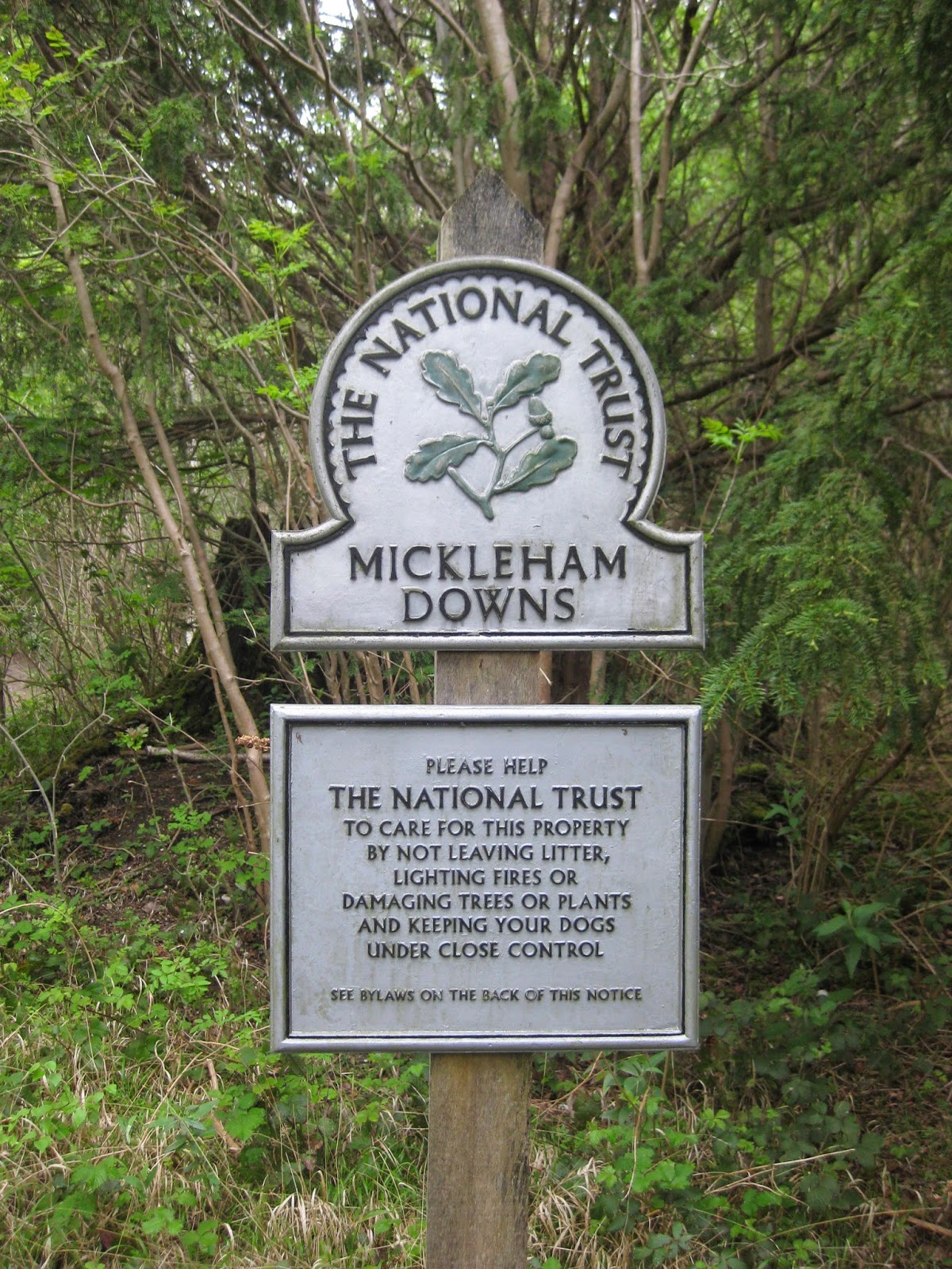
While there we took the opportunity to utilise the nearby footpaths and explore the Downs on the Mickleham Estate. The Downs themselves are National Trust Property and are accessed by footpaths through thick woodlands.

Down in the Village of Mickleham there is this tiny Pub called the King William IV and along side it is a very steep and narrow footpath where one of the Box Hill Tail signs is located.
Please take a look a the website to appreciate the views from the Pubs Small Terraced Garden.
http://www.thekingwilliamiv.com/

This level and walled path at the top of the first part of the hill was an old Carriage Drive used to access the Mickleham Estate many years ago.

The view towards the South West looks across some of the roofs of the Village towards the Denbies Vineyards on the other side of the A24 road

To the North West the view past some ornate Chimneys is across farmland towards the town of leatherhead in the distance.

Ann with one Curious Dog, never known to miss anything.!

On the way up to the top of the downs we came across this enormous tree with some interesting Fungi protruding from the trunk

More Fungi on the opposite side of the tree

At various place on our route to the top of the hill we came across these signs. We were aware that Box Hill was about a mile to the south of where we started and soon realised that there was more than one route to get to the top of our hill using these signs as way markers.
http://www.walkingbritain.co.uk/walks/walks/startmap/walk_start_map/1618/
Walk 1618 - The Box Hill Hike


At the higest point of our walk is a place known as 'The Gallops' and the first item we came across before arriving there is an old Ordinance Survey Triangulation (or Trig) Point.

https://www.ordnancesurvey.co.uk/blog/tag/trig-point/
This piece is from the Blog Site above:
"The iconic pillar, much-recognised by hikers as they reach the heights of their walk, was originally created as a state-of-the-art network to re-map the country. Triangulation is a mathematical process that makes accurate map making possible. It works by determining the location of a point by measuring angles to it from known points at either end of a fixed baseline and in this case, those known points were the 6,500 trig pillars erected across the country. In practice, a theodolite would have been secured to the top mounting plate and made level. It would then be directly over the brass bolt underneath the pillar. Angles were then measured from the pillar to other surrounding points. For the highest accuracy primary points in the Retriangulation, many rounds of angles would have been measured with the observations taking several hours.
The modern equivalent of the trig pillar and retriangulation is the OS Net network of 110 Global Navigation Satellite System (GNSS) receivers, leaving trig pillars largely redundant, although still much-loved."
TRIG POINT 3364 - Identification Plate

This website contains some comments about 3364. There are even groups of people who make it their Hiking Hobby to 'BAG' of visit each of these points, many of which are in remote locations.
http://www.trigpointinguk.com/trigs/trig-details.php?t=4791

The Triangulation Theodolite location on the top.

At the top of the hill we arrive at The Gallops where presumably the route to Box Hill is 'Straight Ahead' ?
Here are views in both directions from where I stood. It was a beautiful day and amazing how quiet and peaceful a place it is with only the tweeting of the birds and the occasional jet overhead on its way to or from Gatwick.
We spent a few minutes on this welcome seat.

On another website about the history of the other Mickleham Inn, The Running Horses, is this piece about The Gallops. In the last century, and using a more gentle winding route people would bring their Horses and Carriages up onto The Gallops to hold Picnics.
There was hoof mark evidence that this sign is needed to protect the old areas.

" In the days before rail travel, the inn was a favourite stabling for horses racing at Epsom. And up until recently, there were training gallops on Mickleham Downs. "


Almost hidden in a small bush is this information board about the local history

On the way back down towards the village we are guided by another Dog Walker to use part of the Track used by the National Trust Land Rovers to reach the area.

This Map found along this route contained this bunch of labels left there by Hikers. Each one contained messages and comments on there day. A nice touch I thought.

Digby being called back up the hill. He will go on at a pace that we oldies cant keep up with. The hill is much steeper than it appears.

A good place for children to enjoy when there at weekends and during holidays.

This was our sign to take a Right Turn back onto a narrow footpath which will take us down to the Village Centre.


The path, we find brings us right alongside the beautiful Church of St Michael and All Angels.
http://www.micklehamchurch.org.uk/welcome.htm

Caught in the Sunshine it makes an impressive site with its bright mixture of Stone, Flint and Red Tiles

Ann in shade of the Lych Gate with our dog who hates the camera.

The magnificent Church Clock indicating how early our Dorking Mornings are as we are finishing our walk today, after first delivering the Grandchildren to school. Up at 6.30am when at home we would only just be thinking of starting out at 11.30am!!!!.

Just across the road is the Village Shop where we will partake of a welcome cup of Coffee utilising their roadside table and chairs. During Term Time the shop benefits as the Tuck Shop, three times a day for the Boarding Pupils at the nearby Boh Hill School. The shop owner informed us that Food at the School is superb, but not to the liking of all, so as a result, they do a good business in Hot Dogs.
http://www.boxhillschool.com/
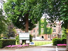
The School

Next to the shop is the popular Running Horses Inn, where, if you can wait until after the 12 mid day opening time, maybe something a little stronger will be on offer.
http://www.therunninghorses.co.uk/about/history
Mickleham was made famous during the 2012 Olympics Cycling Road Races as the course took the riders through the village many times heading for their multiple ascents of the Box Hill Climb. here some of the riders are seen passing the Running Horses Inn. As a result this whole are has become a Mecca for Cyclists.


Our route back to the Mickleham Village Hall where we have left our car, takes us back through the Churchyard where we find this very interesting Rustic Gateway and Ornate Gates st between the Church and the Rectory Gardens.

While back in Dorking I took these two photos of the Actual Box Hill on two consecutive days. One Day Glorious Sunshine - The Next day in the Clouded Fog.

I hope you enjoyed our little rambles
Frank
No comments:
Post a Comment