Actual Miles Driven Today - 246
 |
The High Street, and almost untouched corner of Old Fareham - The Rest has been modernised, if you like that sort of thing. |
Fareham, Hampshire, being the place of my formative years (my actual birth being in nearby Wickham) as approached with mixed feelings.
I was looking forward to meeting my sister and family after such a long time.
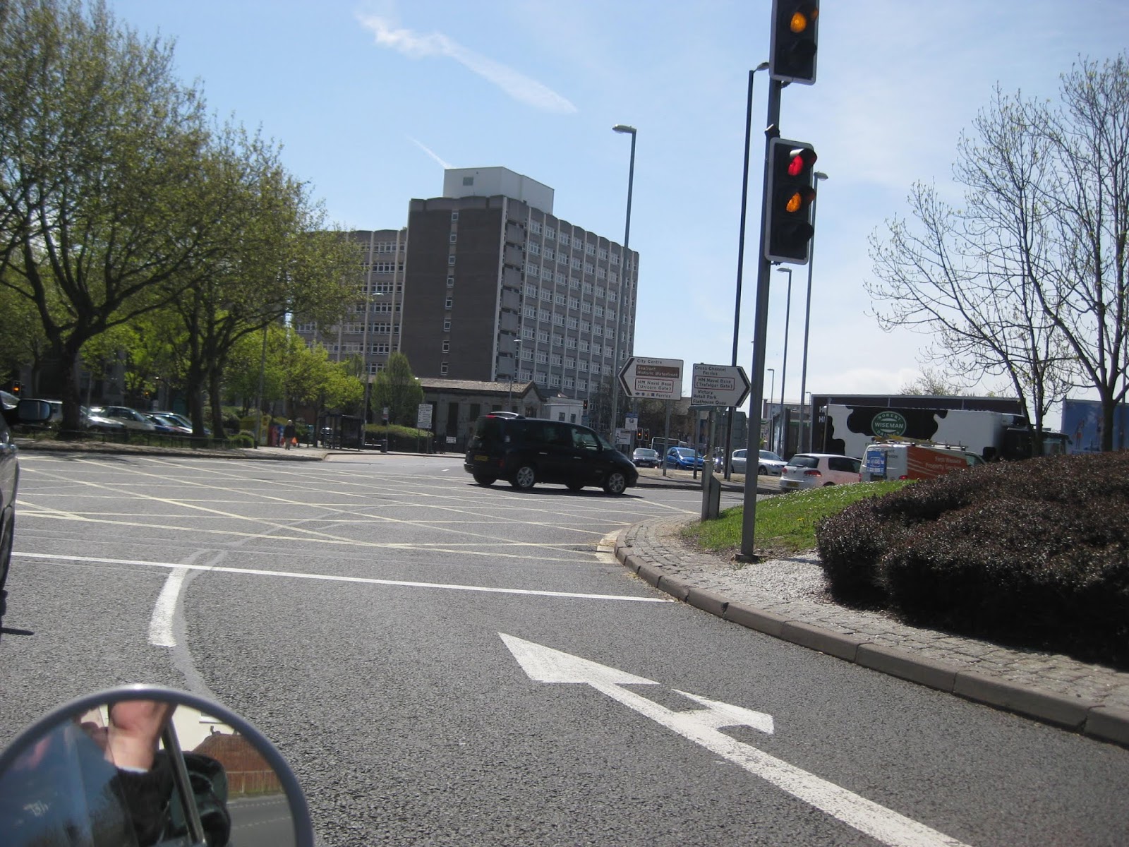
The road layout has changed so much I had difficulty finding the way in.
I also needed to visit the graves of Mum & Dad, and of my Younger Brother who died at 26, all of which I managed to do while here.
The day was always going to be a difficult one due to the numbers of awkward places I had to go to.
It excelled itself as I arrived at my Dover Hotel at 9pm in total darkness having failed to see much at all during the last couple of hours.
During the day my frustration was sitting in long traffic jams which caused me to categorise two groups of vehicle that I seemed to be blessed being stuck behind so many times.
 |
The Rottingdean to Eastbourne Crawl |
Group 1. 'Honky Tonks' - who persist in driving at a constant 10 to 15 mph slower than the speed limit.
Group 2. 'Brick Watzits' - Big Vehicles who always seem to be immediately in front of me so that I cannot see the much needed Road Signs, often until it is too late. ( I had no sat nav for 17 days )
 |
Leaving The Ellerie House Hotel Fareham |
I left the Hotel with a mission to drive the top of what is known as Portsdown Hill which runs the length of the lower road from Fareham to Portsmouth and beyond.
It is the home of what were known as Palmerston's Follies, a series of Forts designed to protect the city.
 |
The Royal Armouries. located at Fort Nelson |
This is the one of these Forts that now houses a part of the Royal Armoury.

Nelson's Column facing Portsmouth Dockyard where his Flagship HMS Victory is on display

The view over Portsmouth Harbour, that these Forts were built to defend.

Passing the next in line Fort Southwick


Outside of A.S.W.E.'s Security Fencing

Another View across Portsmouth from the hill.

Heading back in the opposite direction to begin my days coastal run.

One of the towers found on some modern warships.


Fort Southwick from the other view


Nelsons Bust sits at the top of the column. I discovered that he is actually looking towards Fareham?

A Massive Mortar Gun with enormous Cannon balls stacked at its side.

Rescued from a battleship.

Heading back past Fareham Creek to pick up the coast again at Lee on the Solent

Now to get on with travelling my route. I needed to backtrack towards Southampton to pick up the coast road to Hill Head and then onto Lee on Solent and Gosport.

On The Village Green at Stubbington, the Daffodils have finished flowering.

A Cloudy Sky at Low Tide on the beach at Hill Head

The view across to Lee on the Solent, in the distance, as I drive the narrow Salterns coast road near Monks Hill.

The Monks Hill Beach Huts ahead where I will take a sharp left to climb up the narrow hill road.

Marine Drive West at Lee on the Solent

Central Lee where there used to be a Tower complete with Ballroom and Restaurant, heading a Traditional Pier.
The right hand building used to be the old Railway Terminus Station, long ago converted into an amusement arcade where I spent many a wasted hour during my youth.

Marine Parade East


Nelson's Column facing Portsmouth Dockyard where his Flagship HMS Victory is on display

The view over Portsmouth Harbour, that these Forts were built to defend.

Passing the next in line Fort Southwick

I also wanted to see the Development Base ahead, where friend Barry Murray-Upton and I worked for a while. It used to be called 'A.S.W.E.' for short.

Outside of A.S.W.E.'s Security Fencing

Another View across Portsmouth from the hill.

Heading back in the opposite direction to begin my days coastal run.

One of the towers found on some modern warships.


Fort Southwick from the other view


Nelsons Bust sits at the top of the column. I discovered that he is actually looking towards Fareham?

A Massive Mortar Gun with enormous Cannon balls stacked at its side.

Rescued from a battleship.

Heading back past Fareham Creek to pick up the coast again at Lee on the Solent

Now to get on with travelling my route. I needed to backtrack towards Southampton to pick up the coast road to Hill Head and then onto Lee on Solent and Gosport.

On The Village Green at Stubbington, the Daffodils have finished flowering.

A Cloudy Sky at Low Tide on the beach at Hill Head

The view across to Lee on the Solent, in the distance, as I drive the narrow Salterns coast road near Monks Hill.

The Monks Hill Beach Huts ahead where I will take a sharp left to climb up the narrow hill road.

Marine Drive West at Lee on the Solent

Central Lee where there used to be a Tower complete with Ballroom and Restaurant, heading a Traditional Pier.
The right hand building used to be the old Railway Terminus Station, long ago converted into an amusement arcade where I spent many a wasted hour during my youth.

Marine Parade East

The view towards my next call at Stokes Bay and then Gosport
I made a short visit to see Ann's cousin Colin who has a lovely house on this beach road with fabulous sea views of the Solent to the Isle of Wight.

Colin in his garden.


Views across the Solent from Colin's Home.


Colin with The Green Goddess


Colin in his garden.


Views across the Solent from Colin's Home.


Colin with The Green Goddess

I travelled on into Gosport where I first visited Naval Base of HMS Sultan to get permission to take my Photo.

HMS Sultan also contains another two of those Palmerston Forts, Fort Grange and Fort Rowner.

HMS Sultan contains large Aircraft Hangers but has no longer has its Airfield? It was at one time, RAF Gosport.

HMS SULTAN from across the road.

Between the Base's High Fences

One of the Forts seen heading in the opposite direction

Heading through Gosport towards Portsmouth Harbour

The Harbour View High Rise Apartments

The Gosport to Portsmouth Ferry Terminal

The Ferry Gardens

At Gosport waterfront is the Ferry Terminal to Portsmouth & Southsea. I went there to find the best location to get a photo of the harbour.

The Ferry Terminal and the view to Portsmouth across the harbour. I now need to drive around the harbour to be over on that side.

The Harbour Mouth & Old Portsmouth

It was on to the Submarine Museum next for a short stop (where a copy of my Fathers WW2 War Record is stored).


The approach to the new Haslar Road Bridge which shortens my journey considerably


The approach to the new Haslar Road Bridge which shortens my journey considerably

Haslar Creek from the Bridge.

In the museum car park is this Early Submarine

I popped into the museum just to say hello but there was no time to make a formal visit.

The Submarine Museum with the Twin Dolphins behind the car. When my father was based here it was HMS Dolphin.

Towards the old Royal Naval Hospital at Haslar

The more modern part of Gosport War Memorial Hospital, made famous recently for the high number of unexplained deaths there !

Thorngate Halls, now looking run down, was the home of our Sunday Night Dances where we enjoyed the local live bands in the 1960's.
The highlight for our time was when Manfred Mann played here supported by 'Rod the Mod (Stewart) & The Classics'.

The roundabout at Brockhurst.

Fort Brockhurst, another of the ring of Palmerston Forts surrounding the harbour.

On the way out of Gosport I also visited my old Naval Cadet base of HMS Collingwood.
I had been an 11yr old Cadet here, thanks to my father knowing the Petty Officer in charge. It is now a very High Security Training establishment.
There is no longer any sign of the old Main Gate and Guard Room where everyone entering had to march between two lines on the road and on arrival at the guard house, turn and salute 'The Officer Of The Watch' before marching on.
No 'walk ins' appear to be allowed here anymore.

I was told that this was the nearest I could park to take my photo.

Back on the A27 heading for Portsmouth at the Delme Arms Flyover roundabout.

A Tiny looking Cams Hall in the distance where it is said locally that Lord Nelson used to meet Lady Hamilton when in Portsmouth???
I wondered if this was why his bust in that column on the hill is looking this way?

Through the village of Portchester

Portchester Castle & Keep is just visible in the center with the large Shipyard on the right where the large Cross Channel SRN1 Hovercraft were originally built when it was owned by Vosper Thornicroft.

The new area of Port Solent built on reclaimed land during the creation of the M27 Motorway with its links into Portsmouth.

Portsea Island, the home of the City of Portsmouth & Southsea is the first of my three peninsula's to circumnavigate today.
Along the way I pass the building where my Career in Clothing Manufacturing began in 1961 when it was owned by the C&A Modes company called Canda.
I started writing my life story called 'When I Stepped Down off of the Bus', as this was how I arrived at the Bus Stop there on my first day at work.
Since taking this photo the building has been demolished to form an Aldi Supermarket.
Since taking this photo the building has been demolished to form an Aldi Supermarket.

One of my Over the Head shots of the modernised Johnson & Johnson buildings now converted to a part of Highbury Technical College

I was travelling to Portsmouth using the A road trying to keep to its coast.
It is not possible now as everything merges into two motorway type road junctions with 'lane switching' needed at short notice.
It is no wonder that I found myself in the wrong lane and on the M27 motorway running back towards Fareham again.
It came as a surprise to me adding about 10 miles to my trip and wasting valuable time on this complicated route.
It came as a surprise to me adding about 10 miles to my trip and wasting valuable time on this complicated route.
Ten minutes later I was back in the City trying to find the Harbour.
Yippee, I found it this time.
The Hilsea Roundabout with Portsmouth Evening News building on the left.

The road layouts have changed so much that I am lucky to be in the correct lane.

Heading down the west side of Portsea Island towards Portsmouth Dockyard at the harbour

Old Military Gates retained as a monument

I think I am on what was once known as Queen Street, the old Red Light district?

Eventually I arrive at the Dockyard wall head on the right.

Brick Plinths containing Marine Artifacts.

Turning left just outside of the Naval Dockyard gates.

| HMS Warrior, stem driven The Iron Warship is moored outside of Portsmouth Dockyard but is a part of the museum located inside. |
I already knew that I could not organise a visit into the Main Dockyard to see Lord Nelsons famous HMS Victory up close, therefore, I had to settle for a photo of HMS Warrior as I passed by.

Over the shoulder again, looking back at the Dockyard Main Gates.

Here is the Portsmouth side of the Ferry to Gosport but the buildings also contain The Railway Terminus from London and the Passenger Fast Ferry service to Ryde on the Isle of Wight.
The Spinnaker Tower, with its high level viewing platforms, is Portsmouth's New Feature Skyline.

Ahead lies Old Portsmouth with Gunwarf Keys, the new very smart Shopping Area located to the right of The Lipstick Tower.

The area called Old Portsmouth is just around the corner from the dockyards at the mouth of the harbour, with its old buildings and this beautiful Cathedral.

Portsmouth Cathedral

Turning west again I head into Old Portsmouth along the sea wall.
There in front is a Dagostino's Ice Cream Van. Still trading since I was a young boy.

The road to the harbour and the Isle of Wight Car Ferry Terminal.

Camber Quay with the Cathedral in the background.
Years ago there used to be a giant Coal Fired Power Station located here.

Time to loop back now and drive to Southsea along the seafront

Southsea Common ahead of me before I turn right towards the Funfair.

The Funfair Buildings ahead but no time to ponder as I am already running way behind my schedule today.

The run along the Southsea Seafront is dominated by the large War Memorial but unfortunately it is shrouded in scaffold.


Just past the memorial on the right here is the Blue Reef Aquarium followed by the D Day Museum and Exhibition at Southsea Castle, identified by the military vehicles on the kerb.


Needing a short comfort break I turned into the car park located inside the castle grounds.

Back on the road there are more pieces of equipment to see.

The Terraced Hotel Area of Southsea

On Past the Pier to Eastney where the Royal Marines used to be based.
Their barracks houses another Museum dedicated to the Marines .

The Recovered & Rebuilt South Parade Pier, infamously set alight during the filming of 'Tommy' The Pinball Wizard.
I remember there being some absentees from our factory who had signed as temporary extras during that filming.

The old Royal Marine Barracks and Museum with Gunners Row seen in the background.

Another Mog and Military Base photo.

Leaving Portsmouth & Southsea
The Eastern Road runs northward for me along the edge of Langstone Harbour which divides Portsea Island from Hayling Island, the next of my loops.

The road bridge onto Hayling Island
A few miles later and I am crossing this bridge to take me onto Hayling Island

Through the railings may be seen the remnants of the old wooden Railway Bridge across which the small steam engines would pull their trains carrying visitors on this branch line from Havant Station to the Hayling Sea Front.

The sea front roundabout indicating the two roads which run to the left and the right along the beach or to the Fun Fair.

New Apartment developments

The small permanent Fun Fair area.

| Hayling Beachlands Fun Fair |
I was now way behind schedule so needed to go onto Hayling Island would have to be on a ' straight in and out ' basis.
The popular beaches there are sandy but that is all. The roads become a log jam on a hot summers day caused by having only one entry and exit point across that long bridge.
The popular beaches there are sandy but that is all. The roads become a log jam on a hot summers day caused by having only one entry and exit point across that long bridge.

Approaching Langstone once again

The view towards Chichester & The South Downs

The Witterings and Selsey Bill were my next destination but these are not on an island so will hopefully be an in and out loop.

I need to make two other local visits on this coastline.
Emsworth Harbour was once very famous for its oysters until pollution there caused a number of deaths so their fishing was permanently banned.

Bosham Road End at the waterside where this ice cream van can often be found.
For some strange reason, probably due to the rush, I did not take any photos while travelling through Emsworth and Bosham so I have added the two photos above from later visits.
On the road into The Witterings, I stopped off for a light lunch and saw these two.
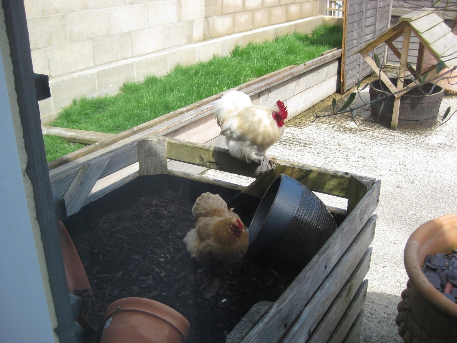
While heading into the Witterings I was to make a stop at a Garden Center I had visited before where I could get some lunch.

In the gardens there are free roaming chickens and I spotted these two looking at me through the window.

Chickens looking through the window.


Time to get going again
East Wittering has Pebble Beaches but West Wittering has the exclusive homes and the very popular Silver Sand Beach, much of which has washed across from Hayling Island.


Towards West Wittering first and then along the coast.


The road to East Wittering is set well back from the beach with no sea view


Towards West Wittering first and then along the coast.

The road to East Wittering is set well back from the beach with no sea view

Into East Wittering, again with no view of the sea.

The small Shopping Center

Now into Bracklesham bay


Ferry Pool on the B2145 near to Upper Norton

St Peter's Church, Selsey

Into the village of Selsey, once the home of astronomer Patrick Moore.

 |
Selsey Beach - More Pebbles  To get to Bognor Regis from here I have to make a deep sweep inland to get around The Rifes (waterways) of Pagham.  Towards Sidlesham   Another slight delay ahead  And into Pagham. The beach is through this gap ahead but this is as close as I can get so have to turn around.  Pagham, Nyetimber and Aldwick form another massive residential area where all roads look alike and the sign posting is non existent once you are off of the main roads. I got totally lost in there and had to follow a bus to find my way out onto this main B2166, Pagham Road and headed towards Chichester skirting around the outside. I was looking for a signpost somewhere to direct me to Bognor Regis. A Car Compass may have been useful at this point.  The Old Windmill in Pagham.  Staying on the B2166 I eventually am able to drive into Bognor Regis through this tree lined suburb.  |
Bognor Regis Sea Front was next as the B2166 takes me to the sea front .
The eastern end of Bognor is dominated by a large 'Butlins Holiday Camp'.
The eastern end of Bognor is dominated by a large 'Butlins Holiday Camp'.

Bognor Regis Sea Front with the Pier Leisure Centre ahead.

The Bognor Esplanade Coast Road

This quieter end of The Esplanade seems to be apartment land.

Leaving the coast at Butlins, I am looking for the B2259 to take me through to Littlehampton.

On the way to Littlehampton I spotted these Thatchers at work.

My next destination along the coast is Littlehampton.
I am arriving, more by luck than by good judgement, which is indicated by the lack of photos from Bognor Regis as I needed to concentrate to find my route.

Travelling around the One Way System, I will find the sea front eventually.

I follow the beach road to Rustington before it took me inland again.
Here I have arrived on the A259, Brighton Road at Worthing.

I can just see Brighton in the distance.

At Lancing I pass the Beach Restaurant on my right.


Warehouses at the mouth of Shoreham Harbour.

Shoreham Harbour is on the River Adur.

And then I travel on through Hove

On The Kingsway in Hove opposite the Tennis Courts.

On the A259 Traffic on Hove Lawns Seafront was moving along fine.

I can just see the the old burnt out metal structure of Brighton West Pier in the distance

I am just exiting Hove for Brighton. There was no time or place to stop so I continued along the coast towards Eastbourne
 |
The Kings Hotel with its flags is on my left.  The famous Metropol Hotel Now called The Brighton Hilton. It was just along from here that The Grand Hotel was bombed by the IRA during the Conservative Party Conference in October 1984  The wreck of the old Brighton West Pierhead.  Just starting to get caught up in the Rush Hour Traffic as I pass The Queens Hotel.  A view of the well preserved East Pier looks further away than it actually is? |
 |
Torture on the Bouncer, near to the East Pier  A Temporary Ferris Wheel located on the lower level Marine Drive.  |
I have now left Brighton but at Roedean School, on the left, the traffic has built up to become an almost stationery queue.
This traffic crawled almost all of the all the 16 miles to Eastbourne.
This traffic crawled almost all of the all the 16 miles to Eastbourne.
 |
Roedean School overlooking the Sea Front   Beacon Mill at Rottingdean is on my left.  Over the Downs, Beachy Head comes into view and later Eastbourne.  Another view of Beacon Mill.  |
Into Rottingdean and still in the crawling traffic.


Approaching Saltdean with Beachy Head in view.
When driving this road you don't realise how close to the cliff edge that you are.

When driving this road you don't realise how close to the cliff edge that you are.


Down the hill into Newhaven

 Turning to cross the bridge at Cuckmere Haven.
The Golden Galleon is now called the Cuckmere Inn?

The Cuckmere River

The river meanders to the sea at Cuckmere Haven.


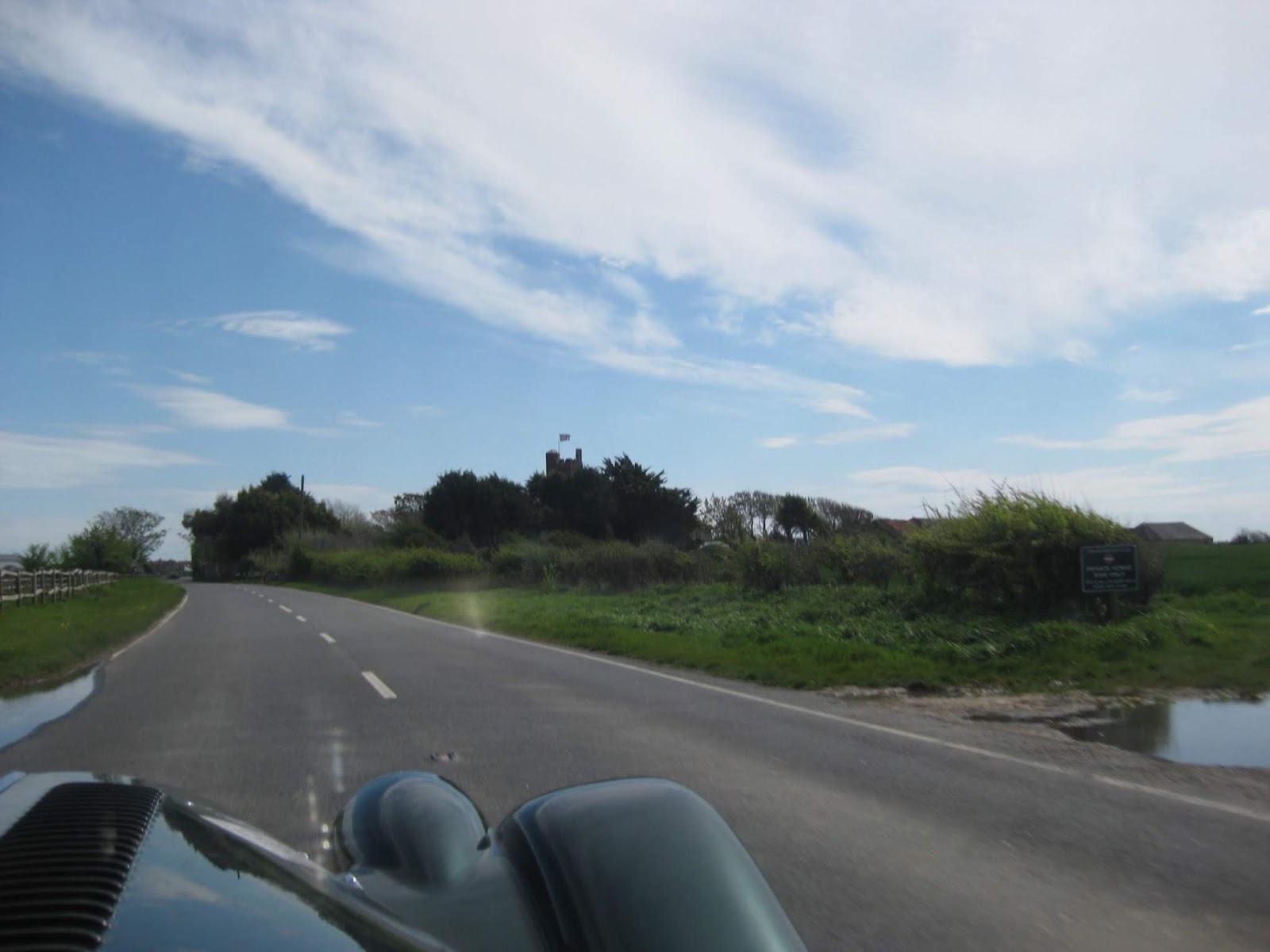
St Mary The Virgin Church at Friston.

Friston Village and East Dean which is near to the Birling Gap.

Over the downs towards Eastbourne

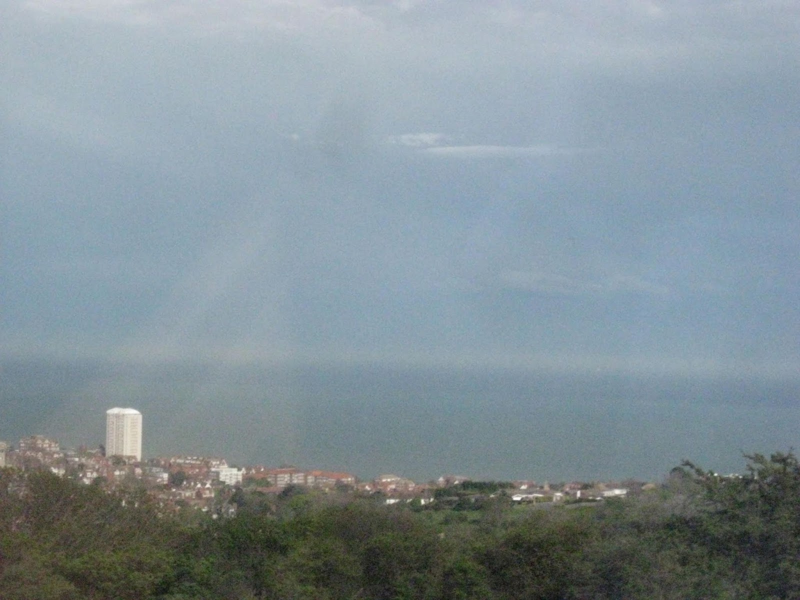
Looking Down at Meads from the downs on the way to Eastbourne

The View of the whole of Eastbourne from the top of the Seven Sisters Downs


On Carlisle Road and almost at the seafront.

Turning left onto the B2103 sea front at The Wish Tower.

My first view of the Eastbourne Beach.

The Seventh Duke of Devonshire, sitting opposite the Bandstand.

Eastbourne Pier in the distance

A better view of the pier and The Carpet Gardens.

Eastbourne Sea Front with the Pier Head building to the right.

Rounding The Queens Hotel

Along Marine Parade.

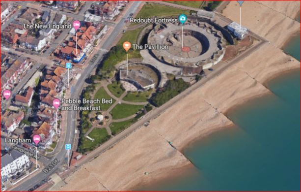
The Redoubt Fortress.

On through Hastings and Bexhill on Sea, heading for Winchelsea and Rye.
On through Hastings and Bexhill on Sea, heading for Winchelsea and Rye.

Going into Bexhill on Sea

On the A259 entering Hastings along the Marine Drive.


Queen Victoria's Statue on Warrior Square

Hasting's very bland pier after a fire destroyed the old Victorian structure.

It was not possible to see Hastings castle from the beach road.

Carlisle Parade.

East Hill funicular railway to the hill overlooking the town.

The Hastings Fun Fair

St Mary's Star of the Sea Roman Catholic Church, on The Bourne A259 leaving Hastings.


Still on the A259 I arrive at Winchelsea, but now I need to find Winchelsea beach.


Winchelsea Church of England Church where Spike Milligan is buried.
It is getting late now and I have to keep to the coast.
It is getting late now and I have to keep to the coast.
I missed the turning to Winchelsea beach road but found it again as I drove through the village.

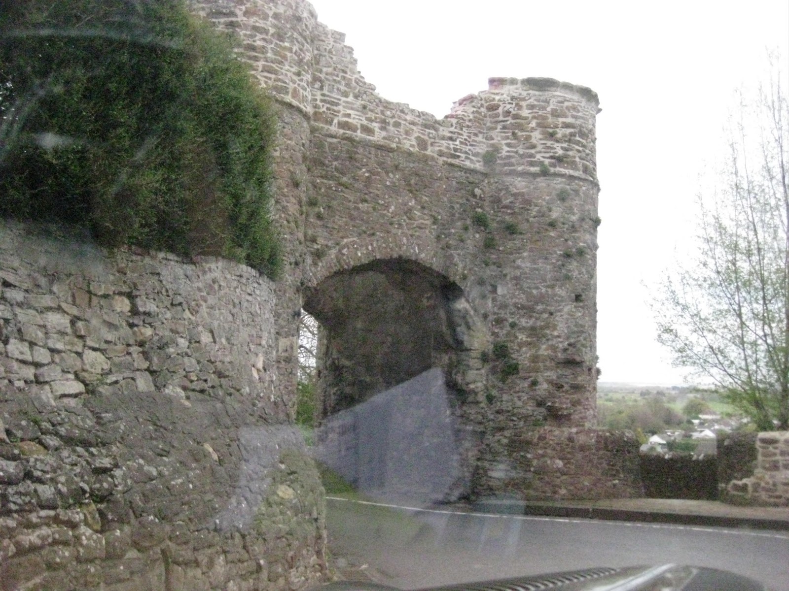 |
| Winchelsea Town Gate |

And onward into Rye where I had to double back to find the beach road again.


Along the Riverside at Rye.
Back eastwards again I eventually arrived at Rye as the evening is starting to close in.


Another 'Over the Shoulder' photo of Rye on the Hill as I head out for Dungeness.


Looking across Romney Marsh as the evening closes in.

Camber Church as I head along the sandy beach road.

Camber Sands, Over the shoulder and ahead.

No time to stop as I find the road into Lydd via Camber, and I head for mystical Dungeness.


Something at Lydd with a very Military appearance on Jury's Gap Road.
Lydd Camp Military Base Gun Range.

The Dungeness Nuclear Power Station through the evening mist.

Towards Dungeness and the Nuclear Power Station

There must be something special about living on this remote and mystical place.

Dungeness Beach Dwellings

The Iconic Wooden Houses

I am trying to get almost to the Power Station where the Lighthouse and the far end of the Miniature Railway.

Dungeness, with its mass of shingle, Lighthouses, Small Wooden Homes and a Nuclear Power Station, alongside the Narrow Gauge turning point of the Romney Hythe and Dymchurch Railway.

I eventually arrive a the lighthouse which is as close to the Power Station that I will get.

The Mog puts the height into some sort of scale.


The Dungeness Station.


I eventually arrive a the lighthouse which is as close to the Power Station that I will get.

The Mog puts the height into some sort of scale.


The Dungeness Station.

 |
The Narrow Gauge rails |
 |
An Advertisement for he Miniature Train Service.  The Round House |
I took my photos as it was just getting dark but the camera has grabbed most of the light available.

The Nuclear Power Station.
I still had a fair way to drive along the coast to Hythe, then Dymchurch, Folkstone and Dover.

The Nuclear Power Station.
I still had a fair way to drive along the coast to Hythe, then Dymchurch, Folkstone and Dover.
 |
Fishing Boats pulled high onto the Beach |
I was due to meet another Morgan owner at the Battle of Britain Memorial but by the time I get there it will be in darkness and closed for the night.


Crossing the Railway, but the Trains ceased to run hours ago.

Along the Coast Drive to Lydd on Sea.


I pass this Martello Tower as I arrive at Dymchurch.

As I leave Dymchurch I pass another converted Martello Tower No 23.


Crossing the Railway, but the Trains ceased to run hours ago.

Along the Coast Drive to Lydd on Sea.


I pass this Martello Tower as I arrive at Dymchurch.

As I leave Dymchurch I pass another converted Martello Tower No 23.
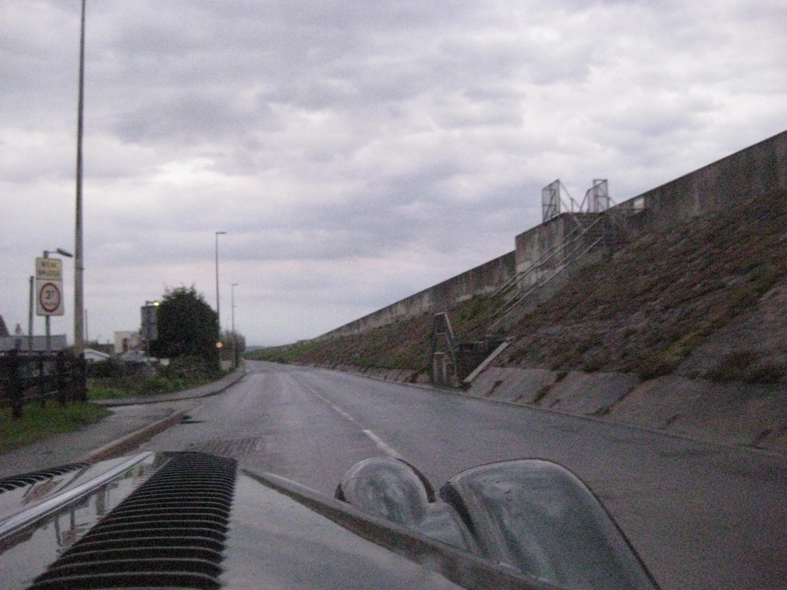 |
The High Sea Wall flood defense on the A259 runs all the way from Dymchurch to the old fort at West Hythe.  The Old Fort  The esplanade at Sandgate.  Marine Parade Folkstone.  Going through Folkstone it is raining and now too dark to get a decent photo on the way.  It was 9pm when I arrived at my meeting place at Capel Le Ferne only five hours late for my meeting with the other Morgan Owners. Sadly I did not have there contact number to phone ahead. I had tried to pack in far too much today on this complicated stretch of coast road.  |
Frustrated, I headed on down the hill to my hotel for a meal, with a welcome pint followed by a good nights sleep.
I will try the Memorial site again in the Morning.
I will try the Memorial site again in the Morning.