Actual Miles Driven Today - 219
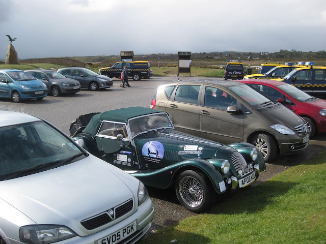
The Over Night Parking Spot
 |
The Green Goddess was tucked away behind the hotel so survived the high winds of the night before.
I was up early and out to give her her daily wash.


I later took some photos of the Hotel and this one shows how it is possible to see the weather changes before they hit you.
This one missed us though.
I was up early and out to give her her daily wash.


I later took some photos of the Hotel and this one shows how it is possible to see the weather changes before they hit you.
This one missed us though.
Rough Weather Passing just off Shore - A Mini Tornado, I am told?
 |
  I imagine that Golf Courses around here are quite challenging, wind wise.  |
It was good to get those Salt Stains off of the paintwork.
She will need a very good sort out after this pasting.
Take the Photo and then get underway again.
She will need a very good sort out after this pasting.
Take the Photo and then get underway again.
 |
After saying my farewells to the guests a breakfast, I was presented with a handsome £20 by one lady.

A local Portknockie Primary School.

My first diversion from my planned route today was after just a few miles as I travelled to Buckie via Portknockie & Findochty with their small harbours

Just a mile from the hotel is Portknockie Harbour

The harbour from the A942.

A Partial View down to Findochty town.

I spot one of the famous Highland Longhorn Cattle and it looks as though he has spotted me.


Just another 1.6 miles and I am on the harbourside at Findochty.


The full sweep of the coast around to Lossiemouth.

An old Three Master moored in the harbour.

A lady that I met at the hotel asked if I intended to visit Spey Bay.
I had not, but I am pleased that I did.
Then, on the way there, I had a run in with a Sleet Storm with the Hood Down.
Spey Bay is an unusual River estuary with Rough Terrain and Shingle Dunes forming a Wildlife reserve.

The area is known as the Dolphin Coast, if you have time and Field Glasses to scan the sea.
I did not stay long there but being a Sunday it was very busy.
The Car Park was full of Coastguard vehicles.
There are coastguards everywhere undergoing training.
I am not sure what this team are up to?
The Car Park was full of Coastguard vehicles.
There are coastguards everywhere undergoing training.
I am not sure what this team are up to?
 |
  A little group of Cormorants drying their wings. These chaps seemed to be jumping in the fast flowing River Spey further upstream and then trying to get back to the shore from midstream as they flowed by. He was told to get his Legs Down as the Current took him. |
 |
There were Training Exercises taking place in three places as the Birds looked on.


The Sanctuary Statue outside of The Dolphin Centre

Travelling on towards Lossiemouth I arrive at the River Lossie where a comfort break is required.


Comfort Break, I think they call it.


The Sanctuary Statue outside of The Dolphin Centre


Travelling on towards Lossiemouth I arrive at the River Lossie where a comfort break is required.


Comfort Break, I think they call it.
 |
I moved on through empty wooded roads to the lovely town of Lossiemouth

A Footbridge to the Beach

A Footbridge to the Beach
 |
The sun was shining now making the Silver Sand in the bay appear magnificent.
The Beach at Lossiemouth
The Beach at Lossiemouth
 |
  |
Knowing that The Royal Air Force had a base here, I sought it out for a photo shoot.
The gate was the nearest I was able to to take my photograph.
RAF Lossiemouth near to the Main Gate
The gate was the nearest I was able to to take my photograph.
RAF Lossiemouth near to the Main Gate
 |
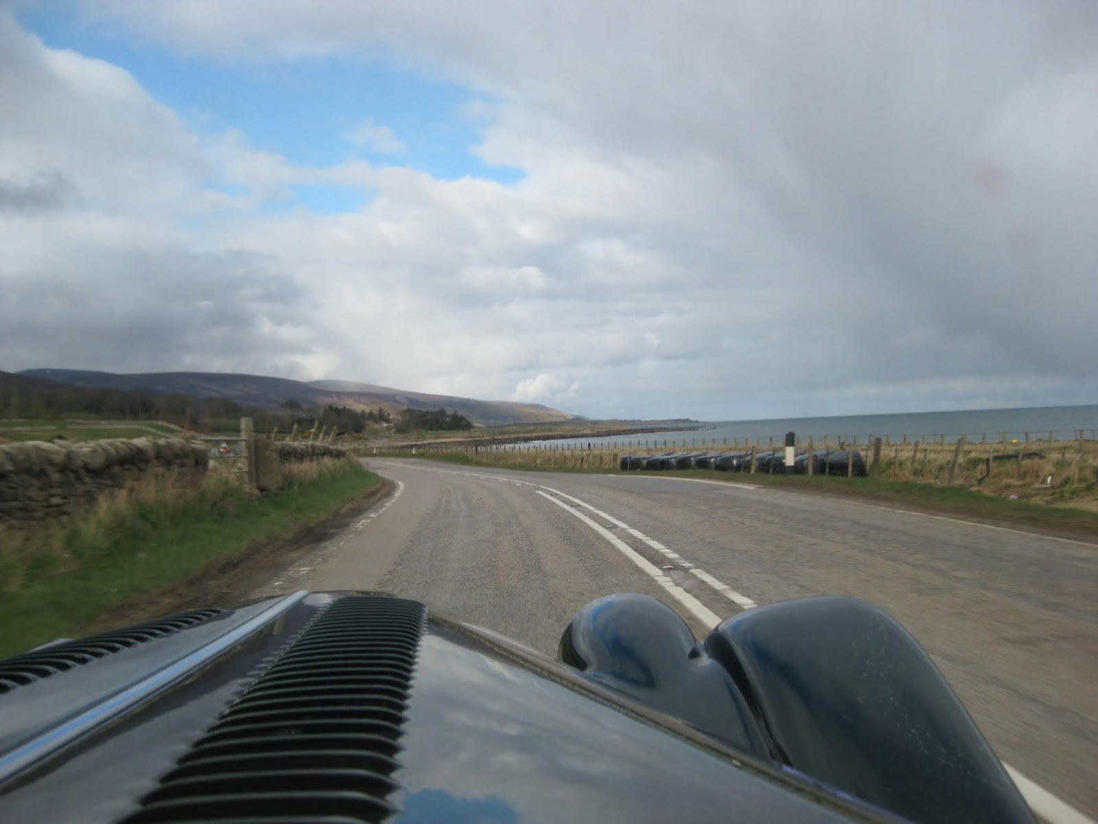
 I am trying to get the background jet aircraft into shot without looking obvious, but the Gate is in the way. My route has missed out the town of Elgin and now I make my way along the coast to another Airbase at Kinloss.  Next to the Silver Sands Holiday Park is the Covesea Skerries Lighthouse.   Further along the road at Burghead I pass this Radio/ Radar station. The Long and Empty Road |
 |
The roads in this area seem to be very long and straight allowing me to open up the R100 for a V6 Burn. |
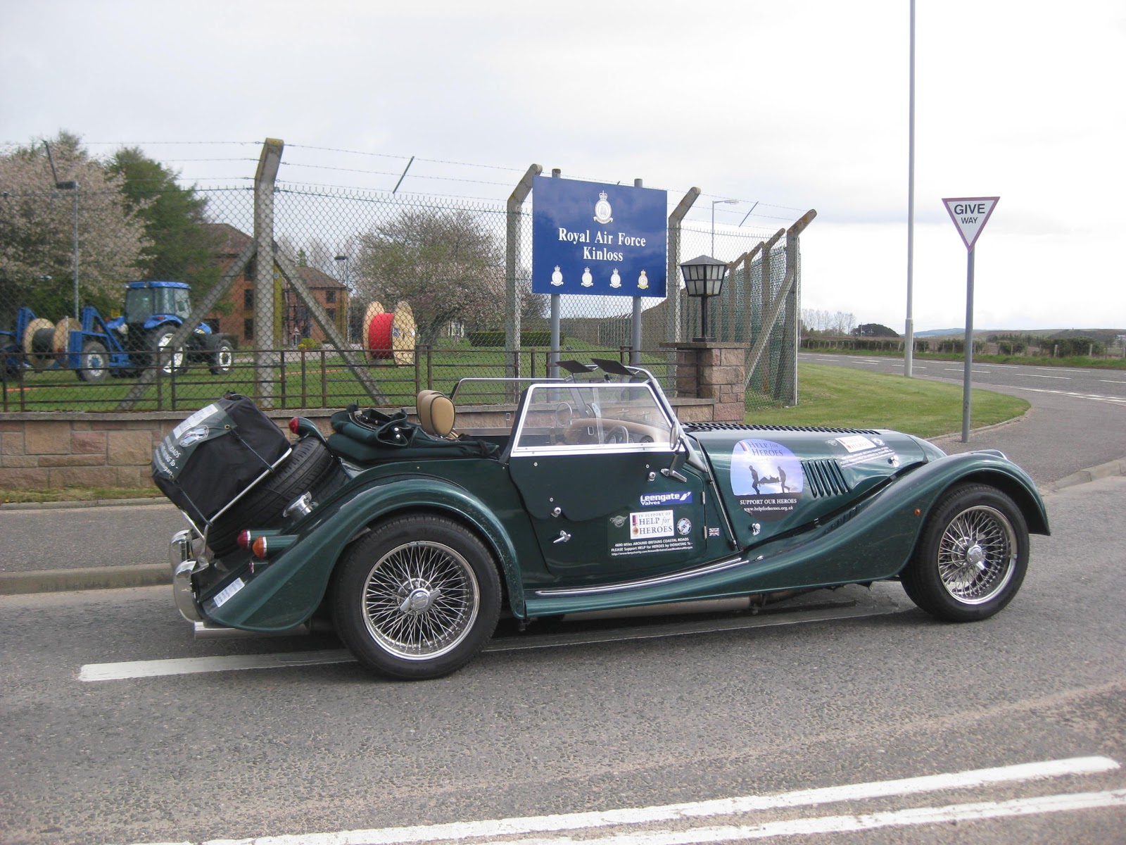
I next went to another RAF Base at nearby Kinloss for the 'Outside of the Gate' photo.

As I leave I get this shot of the Airbase from the other side.

I was on my way to the Findhorn peninsula following another recommendation.
There is another nature reserve at the end of an extensive sandy bay.

Findhorn, located on the River Findhorn, is also the local Sailing Centre.


As I leave I get this shot of the Airbase from the other side.

I was on my way to the Findhorn peninsula following another recommendation.
There is another nature reserve at the end of an extensive sandy bay.

Findhorn, located on the River Findhorn, is also the local Sailing Centre.

http://www.undiscoveredscotland.co.uk/findhorn/findhorn/index.html
The map shows that I have just driven The Moray Coastal Trail. Very Happy I am.
The map shows that I have just driven The Moray Coastal Trail. Very Happy I am.


Findhorn is also a Sailing centre and the small cafe seconds as a Chandlery and Beachwear Shop.
While having my lunch here I took the opportunity to buy myself one of those 'Hood Over Neck Warmers' which went on immediately.


While having my lunch here I took the opportunity to buy myself one of those 'Hood Over Neck Warmers' which went on immediately.


At this point I was unaware that in the area behind the Mog is a large Ecological Settlement set up by the Findhorn Foundation.
The Findhorn Foundation is an NGO associated with the United Nations Department of Public Information, holder of UN Habitat Best Practice designation and is co-founder of the Global Ecovillage Network and Holistic Centres Network. The Foundation is at the heart of a community of more than 500 people who every day support and live the vision of creating a better world by starting with themselves.
https://www.findhorn.org/about-us/

I am about to enter Nairn as I cross the River Nairn Bridge.


There were no more diversions now as I set off to reach Inverness for my first of Three Bridge crossings to North Kessock.
If only I had known then what I know now, I had missed the opportunity to swing north via Ardersier to visit Fort George which I did not know was there at the time.


If only I had known then what I know now, I had missed the opportunity to swing north via Ardersier to visit Fort George which I did not know was there at the time.


The Bridge over the Moray Firth at North Kessock, Inverness.
 |
My route now would take me around the Black Isle all the way down to the town of Cromarty at the head of the Cromarty Firth.

Inverness from the Bridge.
Inverness is the starting point for those who will be setting out to drive The North Coast 500 route.


The Harbour at Avoch.

I can see Fortrose just up the coast.

Another long straight forest road on the A832.


Inverness from the Bridge.
Inverness is the starting point for those who will be setting out to drive The North Coast 500 route.


The Harbour at Avoch.

I can see Fortrose just up the coast.

Another long straight forest road on the A832.

When I met John & Dennis at Whitley Bay Lighthouse, Dennis warned me about keeping to the speed limits in Scotland.
I have been a very good boy doing just that so on this quiet Sunday the last thing I expected behind me was an unmarked Black Volvo with its Blues flashing.
The young police woman and man quizzed me on what I was doing and showed great interest in my project as they warned me to watch my speed..
I knew I had tripped the speed indicator as I came into Cromarty though a very small village and did slow down.
They must have been watching from a side road and nabbed me.
I knew I had tripped the speed indicator as I came into Cromarty though a very small village and did slow down.
They must have been watching from a side road and nabbed me.
The young man's parting suggestion was that every time I am stopped in this way I put £60 in my H4H bucket.
So I am in debt it seems. I used the opportunity to put the hood up during another Sleet Storm that arrive as I was having my knuckles wrapped.
There was such a bitterly cold wind that I decided to leave the hood up for the rest of the journey as I was frozen by now.
On Shore Street in Cromarty.

So I am in debt it seems. I used the opportunity to put the hood up during another Sleet Storm that arrive as I was having my knuckles wrapped.
There was such a bitterly cold wind that I decided to leave the hood up for the rest of the journey as I was frozen by now.
On Shore Street in Cromarty.

 |
 A storage place for Rigs of a sort.  Driving back towards Inverness but along the north coast of the Cromarty peninsula.    |
Ahead, over the field of Rape Oil Seed , is The Cromarty Bridge which I will be crossing very soon.
 |
 |
On the Bridge
 |
On the way back along the north coast I first missed the turning down to the sweeping Cromarty Bridge so had to double back.
Once over the bridge is was a straight run to cross at the Dornock Firth Bridge and head up the A9 to Wick.


More Oil Rigs are visible from this the A9, the main road to Wick.


Just past Tain, at Glen Morangie I spotted a sign for the Glenmorangie Whiskey Distillery - a must for a visit.
 |
Waiting to 'Fill Up' |
I popped into the Distillery only to find that, as it was a Sunday and out of the tourist season, it was closed, so took the opportunity for a photo or two.

I wonder if this is their supply of the peaty water.


The small loch feeding the burn.

The nearest that I cold get to the distillery due to the locked gates.

Back on the A9 road which follows the banks of the Dornoch Firth as I head for the next bridge.

The bridge comes into view.

The A9 is normally very busy as it is the main trunk road north. Maybe driving it on a Sunday out of season is a good idea.


About to cross the bridge.


Through the forest toward Evelix

Nearing Loch Fleet as the road turns back towards the sea.


The views from Golspie Beach


I made a stop in the town centre car park to buy my daily lunch and newspaper.
There I found one of the cleanest Toilets on the whole journey.
There I found one of the cleanest Toilets on the whole journey.
 |
Inspecting the Plumbing again at the Golspie Super Loo. |
I had stopped off in the town of Golspie for a coffee and newspaper.
I donated my Sunday Times Magazines to a more worthy local lady who then donated £2 into my tin for the cause.


Presumably the Wildcat Trails lead up to that Monument on the hill top?

After Golspie the A9 follows the coast once more.

The Clock Tower and War Memorial in Brora


The Yellow Gorse Hills at Lothbeg.


Approaching Portgower.

The Harbour and river mouth at Helmsdale.

The Barren Hills between Navidale and Ousdale

The Hairpin Bend over Ord Burn.


Climbing the switchback hill at Berriedale over the Berriedale Water.


The view down from the top.

I had stopped earlier in Brora to fill up with fuel, paying my first £1.52 a litre.

The bridge below crossing Berriedale Water.
It was just a case now of blasting all the way north to Wick on more fabulous driving roads, including this super Hair Pin Hill Climb here at Berriedale.

The bridge below crossing Berriedale Water.
It was just a case now of blasting all the way north to Wick on more fabulous driving roads, including this super Hair Pin Hill Climb here at Berriedale.

I have the Hood up partly because of the rain showers but also because it is so cold and this helps retain the heat from the heater.

The misty clouds ahead forecast more showers before I get to wick.

Passing through Ramscraigs.

Driving down the hill I get a good view of Dunbeath Harbour so decide to make a stop for a look.


Dunbeath is a small coastal harbour community must like the earlier on I visited at Cruden Bay.

The tidal river.

Across the bay I get a good view of Dunbeath Castle built high on the cliff top.

Latheronwheel is another small Coastal Harbour community. I will soon be turning onto the A99 to Wick, as the A9 turns inland just north of here.


At Lybster I have just 13 more miles to go until I reach my destination at Wick.


More Radio Masts on the coast.


I finally arrived in the hotel car park in Wick just after 6pm as planned, located right next to this ancient Churchyard.
After removing my suitcase and putting on her rain cover I will be leaving Mog in the Car Park once again.
It is not a Happy Moggie to left alone in this one.
 |

The riverside park across the road.

Noisy Rooks nesting in the churchyard trees

The Church Notices

Part of the old Church is in ruin.
More News tomorrow as I head for John O'Groats and then along the top of Scotland to Durness before going south again to Inchnadamph, my next stopover.
http://www.durness.org/
http://www.durness.org/
It is Extra Fuel Day needing to fill my 10 litre plastic fuel can, which I am not keen to do, but needs must travelling through such a remote area.
Hopefully I can empty it again during the day and then give it away.
Hopefully I can empty it again during the day and then give it away.
A tornado?
ReplyDelete