Actual Miles Driven Today - 251
 |
Inchnadamph - meaning, The Meadow of the Dear |
 |
In a Field of Hornless Stags the Horned Stag is King (or so he thinks)
The forecast snow fortunately did not arrive. It rained and blew all night instead.
Living up to its name I was greeted this early and misty morning by a most unexpected scene.
When I opened the curtains, there was a herd of Red Deer grazing in the meadow next door. These were the first I have seen so far.
Apparently they come down from the hills when the weather is bad.

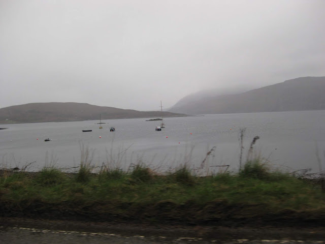
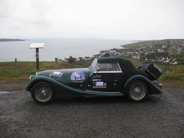
My view down Loch Assynt

At first there was only one.


As they graze they slowly move toward the hotel


The Boss is checking for any danger ahead.

No where is sacred when there is food to be found.
 |
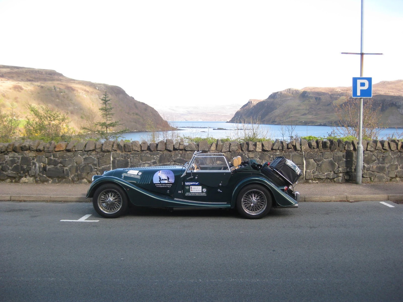
The Road Eater and her Garage for the Night |
Mog was nice and dry having been in the garage all night, so after a hearty breakfast we prepared for the Trip ahead to the Isle of Skye.
No car wash today. Hood up and suitcase loaded, bill paid and I am ready to go on my way once again.

Chatting to owners Richard and wife Jamie, the hotel is frequented by fishermen after the Massive Trout found in the five lochs where they have fishing rights.
Their massive collection of Fish in presentation cases, caught over many years, is testament to the size of these fish.
 |
Leaving the Inchnadamph Hotel |
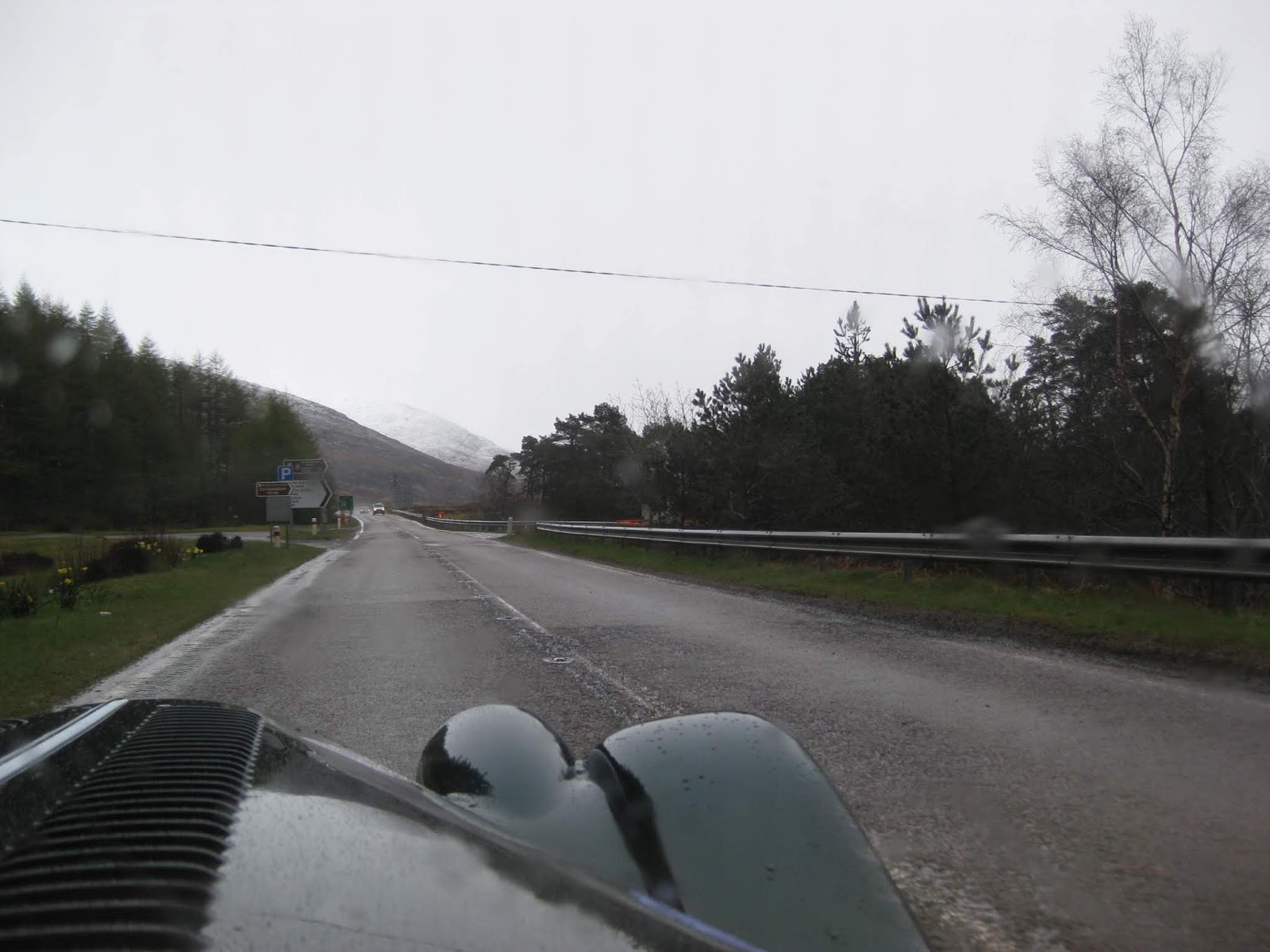
Today was about driving for most of the day in steady but pouring rain so most of my photos are of rain drops on the
windscreen and swishing wiper blades getting in the way.

Here are a few of them so that you will know what I mean.

It was a dark and dingy morning.


Once again I have the road to myself.

It was a dark and dingy morning.


Once again I have the road to myself.

As I approached Knockan
Crag it began snowing.
I wasn't too worried as the roads were just wet and it was not long before I was out of that and back into just rain.


Swish, Swish, Snap, Swish

I wasn't too worried as the roads were just wet and it was not long before I was out of that and back into just rain.


Swish, Swish, Snap, Swish


Without the Wipers going?


The Knockan Crag Botanical Nature Reserve is somewhere ahead.

The snow has laid a little just here.


The terrain is quite barren in this area but it would look stunning on a bright day.

This is a little better as the rain stops for a while.

But not for long as another downpour spoils the view.

I was back down at sea
level soon as I approached Loch Dubba, and then on past Morefield as I
was approaching Ullapool.
Signs of habitation somewhere here.

Down at Loch Level the sky is still heavy and dark.


The sign for Morefield.


Signs of habitation somewhere here.

Down at Loch Level the sky is still heavy and dark.


The sign for Morefield.


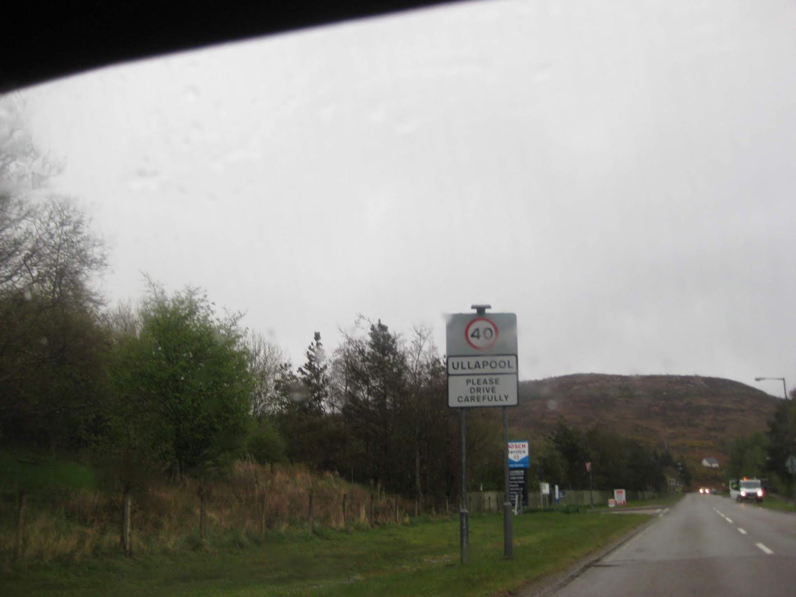
Arriving at Ullapool - time for a little break after the stress of that first portion.

 |
Ullapool Harbour & Lewis Ferry Port |


Gathering for the Ferry


The ferry is ready to depart allowing me to position myself as though I was about to board. Not this time though.

It is time for a pose in front of this Square Rigged Sailing Ship.

Being a Ferry Port to the Island of Lewis, Ullapool is a fairly big town.
I was able to find both a Phone Box to phone home (still no Vodafone signal) and a very welcome cup of coffee in a large mountaineering kit shop.
I also donated to the Gurkha Welfare Trust in the cafe and earned another wrist band to wear.


I am leaving Ullapool to continue my journey.

 |
| That Worrying Sign |
It was just after
Ullapool that I spotted the electronic sign saying that the road was
blocked at Stromeferry.
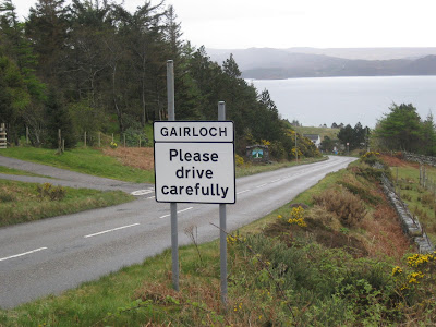
At the time I had no idea where that was but with the suggestion of a 180 mile diversion, I would need to investigate at the next town of Gairloch.
At the time I had no idea where that was but with the suggestion of a 180 mile diversion, I would need to investigate at the next town of Gairloch.


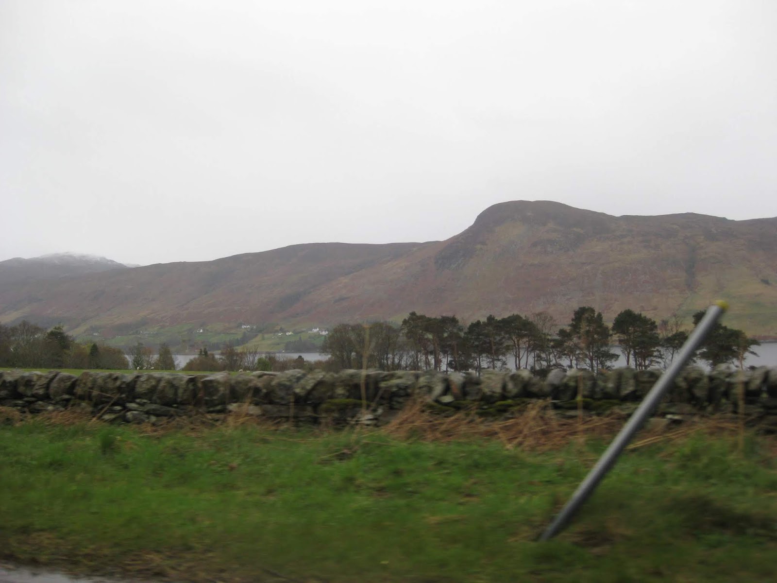
The road from Inchnadamph runs through spectacular countryside and was a fabulous drive despite the rotten weather.
Here are a range of photos to give an idea of the beauty.
The route south along the A835 from Ullapool takes me alongside Loch Broom to its head.


The remoteness of this area provides more miles of almost empty Roads.
They may prove to be more busy during the summer months.


Having passed through the Corrieshalloch Gorge I now need to take this next right turn off of the road to Inverness onto the A832.
I will now be leaving the North 500 Route here and heading west & south towards the village of Letters

The road begins following this wide burn which eventually flows into Abhainn Loch a'Bhraoin which I will not see as the road swings north again before there.


Looking back at my last junction at Braemore. The is plenty of snow on the higher ground.

Last nights rain & snow is causing quite a torrent.

I make a brief stop at the Corrieshalloch Gorge viewpoint.


I continue on towards Gairloch, climbing to ever higher ground.

Bleak, remote and a darkening sky does not bode well for the day.

Now that I have reached the top surprisingly there is no snow up here.


I see two cars so civilisation cannot be too far ahead.


The run on over the hills has given me some great views


This white cottage is the first sign of habitation since leaving Ullapool

I finally approach the Sea Loch of Little Loch Broom


I am about to pass the little settlement at Camusnagaul.


More snow capped hills.


I spot this large viewing area beside the loch and pull in for a short break.


It would be nice to get that hood down but the relentless rain showers it would make the driving most uncomfortable.


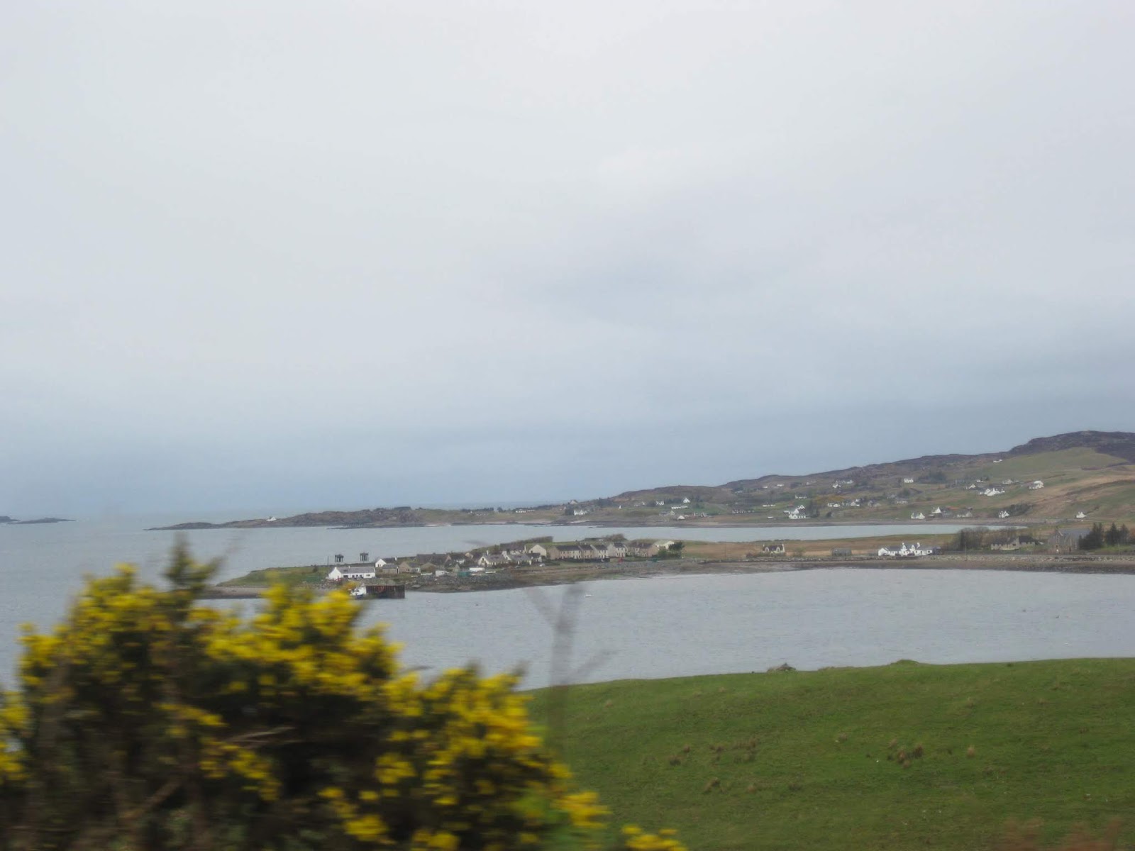
As I approach Mungasdale I get a view towards Gruinard Island


Loch Ewe

Approaching Drumchork with its view across to the Isle of Ewe

The Fuel Terminal there.

Drumchork and Autbea in the distance.


Loch Ewe from the hilltop.

Loch Ewe and the Isle of Ewe


Alongside Loch Thurnaig are these old wartime Gun Emplacements

Passing a landlocked Loch on the other side of the road.

The Inverewe Estate sign

A sign announcing The Inverewe gardens.

Entering the town of Poolewe.


A quick shot of the River Ewe through the side window.


The road here cut inland again to head across country to Gairloch.

I am soon passing inland Loch Tollaidh

I pull into this viewpoint for this shot across Strath Bay to Strath and Gairloch.

Down the hill and I am soon entering Gairloch


This white cottage is the first sign of habitation since leaving Ullapool

I finally approach the Sea Loch of Little Loch Broom


I am about to pass the little settlement at Camusnagaul.


More snow capped hills.


I spot this large viewing area beside the loch and pull in for a short break.


It would be nice to get that hood down but the relentless rain showers it would make the driving most uncomfortable.


As I approach Mungasdale I get a view towards Gruinard Island


Loch Ewe

Approaching Drumchork with its view across to the Isle of Ewe

The Fuel Terminal there.
Drumchork and Autbea in the distance.


Loch Ewe from the hilltop.

Loch Ewe and the Isle of Ewe


Alongside Loch Thurnaig are these old wartime Gun Emplacements

Passing a landlocked Loch on the other side of the road.

The Inverewe Estate sign

A sign announcing The Inverewe gardens.

Entering the town of Poolewe.


A quick shot of the River Ewe through the side window.


The road here cut inland again to head across country to Gairloch.

I am soon passing inland Loch Tollaidh


I pull into this viewpoint for this shot across Strath Bay to Strath and Gairloch.


Down the hill and I am soon entering Gairloch


 |
| Gairloch |
I had a mission here to try and find the Gairloch Hotel run by a friend of my boss back in 1978. When I got there I discovered that the hotel was under the management of Shearings, the Coach Tour Company.
My plan to have lunch there was scotched by a hotel full of tourists. I found out later that I should have been looking for a Pub, not the Hotel, However, my bosses owner friend had sold up and moved away years ago. Well, I tried!
 |
| Reg & Maureen Pritchard who gave a generous donation to H4H |
My first visit was to the Police Station to get the latest news which turned out to be goo in that as long as I got to the landslip there would be a Convoy going through the roadworks at 4.20pm.

At the back of the Police Station someone has aquired a complete Lighthouse Lamp and built it into their cottage.

It was lunchtime at the local school and these enthusiastic youngsters gathered to find out what I was up to.
I explained the task to them and why I was supporting Help for Heroes. I presented each of them with a wristband and made a donation on their behalf.
I explained the task to them and why I was supporting Help for Heroes. I presented each of them with a wristband and made a donation on their behalf.
 |
| Kieran, David & Ian from Gairloch High School |
Just as I was leaving I took on fuel whereby I heard that there was a second roadblock. An Army Truck had slipped into a ditch just outside of Gairloch.


 |
Army Lorries in the Ditch ahead.

A Second Army Lorry was the one blocking the road when I came along.

As soon as I was allowed to pass, I had to get on with the long drive down to Stromeferry where the Road Block's only Timed Convoy would be leaving at 4.20pm.
Miss this convoy and the who trip will go into chaos mode.


The scenery through the mountains was still spectacular despite the weather. here are more images.
Miss this convoy and the who trip will go into chaos mode.


The scenery through the mountains was still spectacular despite the weather. here are more images.
 |
A rough piece of road ahead.  |
 |
Beinn Eighe in the distance    Beinn Eighe grows larger as I get nearer.   Alongside Loch Maree        Approaching Kinlochewe where I need to take a right turn onto the A896 to head for Torredon     Get ready for a rumble as I approach a Cattle Grid for the first time. This normally means that there is likely to be cattle roaming on the road.  |

The road misses Torridon as we approach Annat on Upper Loch Torridon.


What looks like a Travelling Theatre at the Torridon Inn


Arriving at Sheildaig on Loch Sheildaig


An unusually rough piece of road as I approach this crest.

Passing Loch Damh

A sign announcing Loch Carron


Suddenly I am running alongside the single track railway from Inverness to Kyle of Lochalsh.

Just after Attadale, it was not long before I was arriving at the road block just as the convoy was about to set off through the road works.
 |
The beginning of the road works  |
 |
Heading for the Rock Fall Protection Tunnels |

 |
The Crumbling Rock Face  In the Convoy - I made it just in time.  Passing the few homes of Ardnarff.  I find this suitable lay by as the road winds up through the forest. Time for a rest and relaxation after the rush to the convoy. Now that I was through the Rock Fall I could relax and take my time with a stop for my sandwich lunch in a lay by. |


I am not sure why I took this photo but all was well.

While here I took a photo of my failing rear chip guard. The constant soaking caused the material I had used to fail despite the many coats of underseal I applied before fitting them.
An extra row of bolts near the top would have prevented this happening.
Later on in the journey through Wales I would stop and remove them due to the constant zinging sound as they curled even more and rubbed on the tyres.
An extra row of bolts near the top would have prevented this happening.
Later on in the journey through Wales I would stop and remove them due to the constant zinging sound as they curled even more and rubbed on the tyres.

This super viewpoint is located right above Stromeferry providing a view along Loch Carron.

Just up the road I stopped again in a better spot overlooking Lochalsh.
I would soon be running along the Lochside towards the Skye Bridge at Kyle of Lochalsh.

Looking across the Loch to Strome on the opposite side. Strome Castle is over there somewhere.


The weather has perked up so I take the opportunity to lower the Hood for the first time today.

I spot this sign for Plockton but it is not on my route today. I will maybe make a visit there on my way back from Skye.


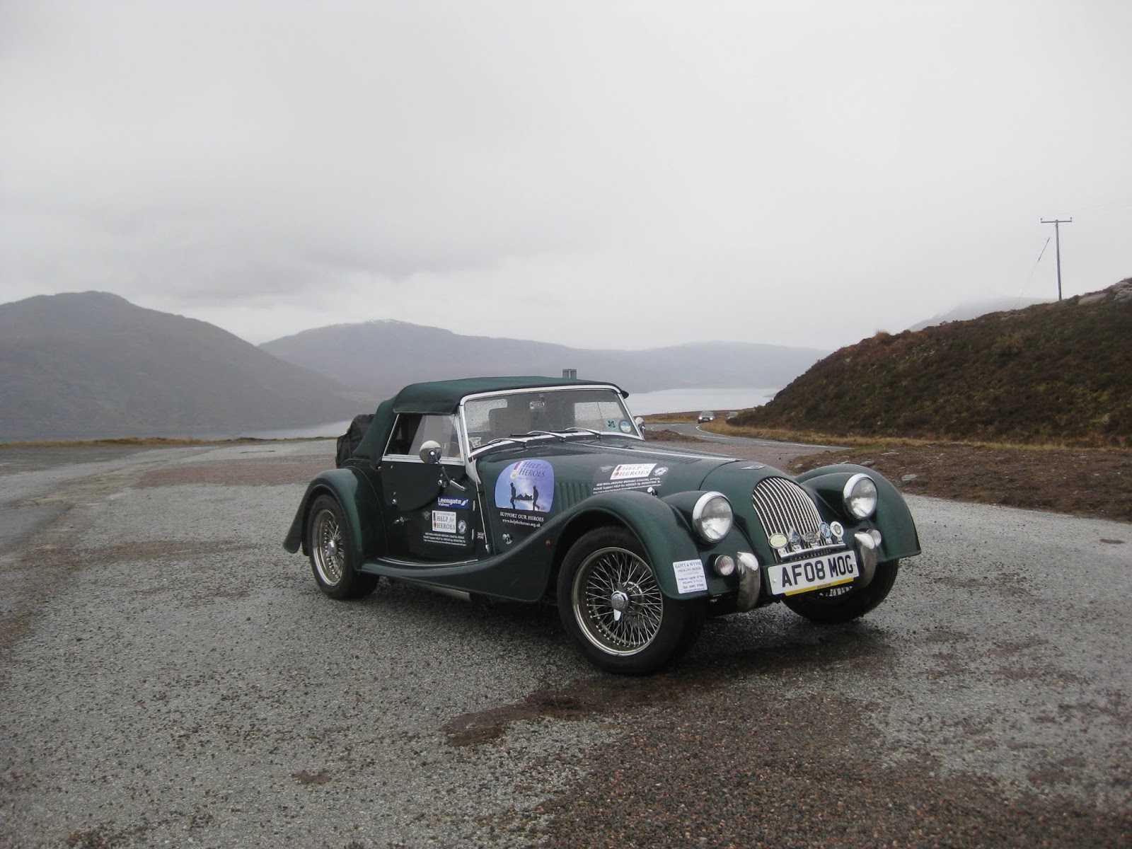
An 8% downhill slope for 1 mile.

Ahead of me is Loch Alsh

Approaching Auchtertyre where I will be turning right to head for Kyle of Lochalsh.
I always though that it was a fascinating name when in my youth as a train spotter it was the name of one of the engines using our local line.


I would soon be running along the Lochside towards the Skye Bridge at Kyle of Lochalsh.

Looking across the Loch to Strome on the opposite side. Strome Castle is over there somewhere.


The weather has perked up so I take the opportunity to lower the Hood for the first time today.

I spot this sign for Plockton but it is not on my route today. I will maybe make a visit there on my way back from Skye.


An 8% downhill slope for 1 mile.

Ahead of me is Loch Alsh

Approaching Auchtertyre where I will be turning right to head for Kyle of Lochalsh.
I always though that it was a fascinating name when in my youth as a train spotter it was the name of one of the engines using our local line.


At last I can see the Skye Road Bridge in the distance.


I am now on the road to the bridge.
 |
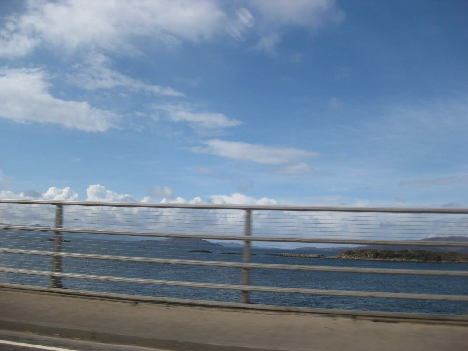
Shooting the Isle of Skye Road Bridge


No sooner had I entered Skye than the weather improved and the sun came out and the sea turned a royal blue.

I had decided to alter my plan to go straight to the Hotel as it would mean driving clockwise around Skye.
My mission was go go Anticlockwise so I set off for the longer journey.


My mission was go go Anticlockwise so I set off for the longer journey.


Before offering a choice of direction the town of Portree has to be visited.


Then it is back to remoteness and more mountains

The seascape is spectacular around the northeast.


The Kilt Rock comes into view. A feature of Skye Mountains it would seem.
 |
Kilt Mountain

Approaching the village of Staffin.


My most northerly point on the island.


Approaching the village of Staffin.


My most northerly point on the island.


Kilmuir and Stenscholl Church of Scotland


The Ferry leaving for the Outer Hebrides.


Overlooking the Calmac Ferry Port at Uig.


The Hairpin Bend on the A855


At the Ferry Port.


I was soon pulling up in the car park at my Hotel for the night.
The mountain and hills over the loch resemble a reclining figure of a giant thus the locals call it Giant Rock.
 |
| Giant Rock in the background |
It was not long before Mog was unpacked and tucked up for the night at the Tables Hotel where a welcome meal was waiting for me.

The sun was just setting for the night so I took a short walk for some sunset photos along the loch side.

This series of Architects Models of Ecological Homes built on Skye were on show in the local estate agents window.


This series of Architects Models of Ecological Homes built on Skye were on show in the local estate agents window.


The Church of Scotland Church in Dunvegan.

The Loch at night.


A Pirate of the Fishing Fleet.


On the drive to Dunvegan Castle the Daffodils are in full bloom.

One of the Castle Turrets are seen through the treetops.
https://www.dunvegancastle.com/


The full body of the Sphinx like terrain of the hills opposite.

Table Mountain.

My last view from my bedroom as I settle in for the night.
I have just spend an enjoyable 10 minutes catching up on your trip. You certainly are getting the hang of writing a Blog (With hyper-links as well I see now).
ReplyDeleteWell done Frank.
cheers
_________________________
Steve A11OGE Red 1989 4/4 4 seater
'A Morgan is for life, not just for Sundays'
Wonderful account. Needed the extra fuel?
ReplyDeleteHi Tony, The extra fuel is still in the tank as I have managed to plan refills where there are multiple stations.
ReplyDeleteI see in todays paper that the Tanker Drivers may be disrupting so I will hang onto the 10 ltrs until I know the outcome.
Scotland did not need to panic buy, I weas told, the last time as their supplies are non Esso/shell, but even Tesco & Morrisons seemed not to be effected?